
New Mexico Streets: Address to Parcel
A street-by-street search works best when each step leaves a record key for the next one. Begin with the county, since New Mexico has no single statewide assessor or deed index. Keep the full address as written, including direction and suffix, but be ready to test a shortened version if a portal finds nothing. A parcel ID connects a tax record to a map and can lead to the legal description used by the county clerk. Record the date and source for each result. The current owner field is a tax-roll entry; it is not a full list of people who may live there.
- Find the county and assessor record. Search the address in that county's assessor system. Write down the parcel ID, situs address, owner name, mailing address, tax year, and any visible data date or disclaimer.
- Open the matching parcel in GIS. Turn on address and parcel labels where available. Check the parcels along the street and around the starting lot, then note map codes, overlays, and any link back to the assessor.
- Use the parcel's legal description at the county clerk. Search the current owner as a grantee near the likely purchase period. A deed names the grantor and grantee, the parties transferring and receiving an interest.
- Trace the deed chain backward. Record the instrument number, recording date, book and page or document number, and legal description. Search the prior owner as a grantee, checking that the lot or subdivision still matches.
- Add other dated evidence. Check address-based permits or code files, then consult public voter information only within its privacy limits. An older reverse directory can identify a person listed at an address in a particular year.
For a house-history question, the sequence is parcel, owner, deed, then dated household sources. Stop when the lot description changes or a file is no longer indexed. Ask the clerk which book, counter terminal, or archive holds the next link instead of treating a missing online result as proof that no record exists.
Bernalillo's Number, Street and Parcel Search
Bernalillo County's public property search supports both a numbered address and a street-wide query. If a number-and-street search misses, the research notes say the street suffix may be omitted and a street-only search returns addresses on that street. Parcel ID is an alternative key; an asterisk can search a group or a prefix pattern. Tax year is a filter, and the available years can change. The portal also offers sort controls, though the text inspection did not expose a fixed list of sort choices.
| Field Label | Type | Required | Options / Format Notes |
|---|---|---|---|
| Number | text | optional/paired with Street | address number; example 10332 |
| Street | text | optional/paired with Number | suffix may be omitted; street-only returns all addresses on that street |
| Parcel ID | text | optional alternative | * wildcard searches a group, prefix, or prefix/suffix pattern |
| Tax Year | dropdown | optional | tax-year filter; exact options are dynamic |
| Sort by | dropdown/control | optional | sort options are dynamic in text capture |
| Search | button | no | submits query |
Open Bernalillo County Assessor public access to see the disclaimer and entry point for its property search.
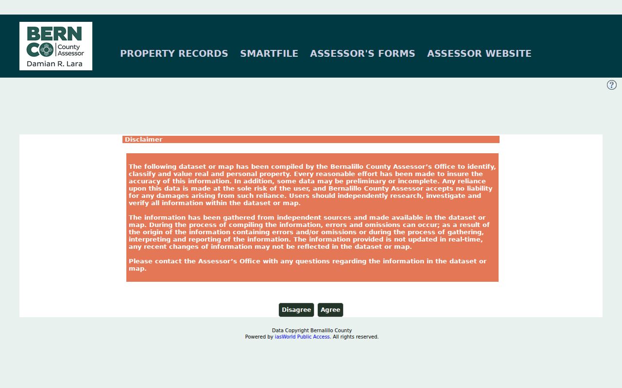
The captured screen is a starting point, not a verified parcel record. The assessor warns that data can be preliminary, incomplete, not real-time, or subject to error, so confirm an important detail with the county.
Public Records Along a New Mexico Street
The same address can appear in several record systems, but each system answers a different question. County assessors maintain parcel and valuation information; county clerks hold recorded instruments; a treasurer tracks the tax account. Planning offices may hold permits, while GIS adds the parcel's map location and nearby layers. The table keeps those records separate so a street search does not turn a tax entry into a claim about who currently occupies a building.
| Record Set | Keeper | What It Shows | Access |
|---|---|---|---|
| Assessor parcel card | County assessor | Owner, situs and mailing addresses, parcel ID, values, exemptions, and property details when shown | County portal or counter |
| Tax account | County treasurer or assessor | Tax year, account status, parcel, and owner links | County tax search or request |
| Recorded deed | County clerk | Grantor, grantee, instrument date, legal description, and transfer clues | Index, image portal, terminal, staff research, or copy request |
| Plat or subdivision | Clerk, assessor, or planning office | Lot, block, easement, replat, and the bridge from street to legal description | Clerk, assessor, GIS, or planning counter |
| GIS parcel | County GIS or planning | Parcel shape, address, map code, nearby parcels, and published overlays | Web map, atlas, or counter |
| Permit or code case | City or county planning/code office | Public work, inspection, applicant, or notice details that the custodian releases | Local portal or focused IPRA request |
| Voter record | Secretary of State or county clerk | Public registration fields, subject to protected-field rules | Status tool or county-file request |
| Reverse directory | Library or archive | A historical name associated with an address in a specific volume | Local collection, microfilm, or licensed access |
A parcel number is often the bridge between the assessor and GIS. A deed's legal description can then connect a current parcel with an earlier instrument, even if the street label has changed. The permit office follows the jurisdiction that issued the permit, which may be a city or the county. Coverage and online access are local, so check the named custodian rather than assume that one portal covers all of New Mexico.
New Mexico Street GIS and Address Layers
County GIS is a map companion to the assessor, not a legal survey. Bernalillo County's address atlas includes address annotations and parcels, while the county says Planning and Development Services assigns official addresses in the unincorporated area. The atlas warns that its maps are for reference and should not be used for exact measurements or legal descriptions. For a deed boundary, use the recorded instrument or obtain a survey from the proper professional.
Doña Ana County publishes a different set of useful search mechanics. Its official GIS map help says to leave off the street prefix and suffix for better matching; a street-only query can return matching addresses. Selecting the magnifying-glass result highlights and zooms to a parcel. A Parcel ID may open a property photo when one is available, and a Map Code opens the assessor result. These are documented controls for Doña Ana's GIS system, not statewide labels.
Read the Bernalillo address atlas introduction for its address-assignment and map-use notes. The state's Taxation and Revenue GIS service supplies boundary and tax-district data, but it directs users to each county assessor for parcel data. That split explains why a statewide map can help orient a search while the county remains the source for an owner's parcel card.
New Mexico Deed Chains by Address
County clerks record real-estate documents, but New Mexico has no single statewide deed index. Santa Fe County's published workflow is a useful example of what to expect from one county. Its ClerkTrackWeb portal searches real estate and other recorded documents, accepts card purchases, and emails documents. The clerk's guide identifies party type, instrument number, book and page, and document type as search fields. A recorded instrument number is the unique key for a deed or lien and can make a follow-up request more precise.
Santa Fe offers a public index route and a public self-service route. Its clerk says the public foyer computers are free during business hours, while standard copy fees apply. For index search followed by pickup, a researcher can locate the instrument number, email the clerk, and allow two business days. The office lists staff address and chain-of-title research at $40 for the first 15 minutes and $40 per hour after that; the results are unofficial and not guaranteed. Those terms belong to Santa Fe County, not every New Mexico clerk.
View Santa Fe County ClerkTrackWeb, the county's public recording search and document-purchase interface.
The portal screen illustrates the document-search route; it does not establish that every county has the same fields or online image range. For older or missing records, ask the county clerk about counter terminals, paper books, microfilm, copies, and the local fee schedule.
Santa Fe also distinguishes recorded real-estate work under the Recording Act from a broad request under the Inspection of Public Records Act. The Santa Fe County Clerk's public-records access page describes its portal, counter, and staff-research options. For other public-agency records, a focused IPRA request should name the address or parcel, record type, date range, county, and desired format. A written request also identifies the requester and contact details; inspection is prompt and no later than 15 calendar days, with a written status explanation if a record is not available within three business days. IPRA does not make a deed index statewide, nor does it require a clerk to create a record that was never kept.
New Mexico Street Addresses, Explained
Three address terms can look interchangeable on a screen but point to different records. Keep them separate when copying details from a parcel card or deed. The property address is the best starting key for a street search, while the legal description controls the land being conveyed.
- Situs address
- The physical location assigned to the land or building. This is usually the address used for a street or GIS search.
- Mailing address
- The destination for tax notices or other correspondence. It can be elsewhere and does not show that the owner lives at the property.
- Parcel ID or map code
- A county's machine-readable key for a tax or map record. Names and formats vary by county; it is not a postal address.
- Plat
- A recorded map of lots, blocks, or a subdivision. It can connect a street number to the legal description, but is not a substitute for a survey.
New Mexico parcel pages may show an owner's mailing address apart from the property's situs address. A trust, estate, company, out-of-state owner, or old tax record can explain the difference. The mailing location is a lead for record research, not evidence of current residence. Capture the record date and check a deed when the question is about ownership rather than the tax roll.
New Mexico Address Permits and Code Files
Permits and code cases can date work at an address, but their custodian follows the government that issued or handled the case. A city building permit belongs with that city; a county permit belongs with the county planning office. Public files may include a permit type, applicant or contractor, inspection dates, status, violation notice, or case number, subject to the record's disclosure rules. The research did not locate a statewide field inventory or common coverage dates for New Mexico city permit systems.
Albuquerque permits and code records are useful address evidence, yet a uniform online search was not confirmed. When a portal does not expose the needed entry, contact the relevant city or county records custodian and ask about inspection, download, or a written IPRA request. Be specific: give the street address, parcel or permit number if known, the kind of record, and a date range. Ask whether the response is an unofficial lookup or a copy of the filed document.
Permit records can help place a repair, addition, or public inspection in time. They do not by themselves identify everyone who lived at the property. If a request draws a blank, check whether the address was assigned by the city or county, whether the work predates the available index, or whether the file is held under a parcel or case number.
New Mexico Voter Records Along a Street
The New Mexico Secretary of State's My Registration Information tool is for checking an individual's status and voting location. The live form's exact input labels were not exposed in the research inspection, so no street-wide name field should be assumed. A public voter-file request is a separate route through the county clerk or Secretary of State. Public records can show certain registration details, but they do not provide a complete household roster or ballot selections.
| Field or Feature | Type | Required | Official Notes |
|---|---|---|---|
| Name/registration identity | online lookup input | Not exposed in text inspection | status tool is the NM SOS My Registration Information route |
| Registered address | result field | n/a | used to determine precinct and ballot; voter must update after moving |
| Party affiliation | result/registration field | n/a | party choice optional; DTS/No Party exists; public registration may show party |
| Registration status | result field | n/a | active/inactive/cancelled maintenance status may apply |
| Precinct/districts | result field | n/a | ballot contests derive from physical registration address |
| Voting location | result/tool output | n/a | voter services returns where to vote |
| Birth day/month and SSN | protected field | n/a | SOS says always privacy protected |
| Ballot choice | never public | n/a | vote choices are secret |
Use the official New Mexico voter status and voting-location tool for an individual check. For public-file access, ask the county clerk which fields are included, withheld, or redacted and whether the file is offered for inspection, as a printout, or electronically. No statewide full-file fee or delivery format was verified in the research.
A registration address is a physical election address, not proof that the voter still lives there. Moves, list maintenance, address updates, and confidentiality programs can change what appears. Safe at Home participants use substitute-address procedures, so a protected address should not be treated as a missing record to fill from another source.
Old New Mexico Streets in Reverse Directories
A reverse or criss-cross directory begins with the address and points back to names listed in that volume. It can help when a surname is spelled in an unexpected way or when a household head does not appear in a name index. Read the page for the year printed, the directory's city boundary, and its abbreviation key. Later volumes may include a phone number; an address-first listing can also omit non-subscribers, institutions, or rural routes.
When a modern street label does not match an old directory, compare the number with maps, subdivision plats, nearby addresses, and a parcel's legal description. New Mexico research documents an 1898 Albuquerque map with city limits, streets, blocks, businesses, railroad, wards, plats, and subdivisions. Santa Fe maps from 1931 and 1936 provide another local bridge. The sources do not establish a single statewide street-renumbering year, so test old and current labels city by city.
For the directory year runs, library locations, and field-by-field reading notes, use the New Mexico city directory collections page. That keeps the historic shelf separate from the current county parcel and deed chain.
New Mexico Street Search Limits
A parcel search is strongest for land and the owner named on a tax record. It does not reliably reveal every person currently in a household. A registered voter is only one public record, and protected voters may not display an ordinary residential address. A deed records an interest in property, not day-to-day occupancy. A map can also be offset or out of date, and the assessor warns that its data may be incomplete or not real-time.
Do not treat the absence of a name as proof that nobody lives at an address. A name can be missing because the person is not in the specific record set, the index has a spelling variation, the local portal is offline, or the relevant details are protected. New Mexico's driver-address data is restricted under the federal Driver's Privacy Protection Act, and utility customer lists are not ordinary public street rolls. Use the public custodian for the record it holds.
Lawful personal use. Public address records can support personal research, family history, and civic understanding. Do not use them to stalk, harass, threaten, or harm anyone.
ZIP and city labels need the same care. The postal city on an address is not necessarily the incorporated municipality, county, school area, or voting precinct. Use the USPS ZIP lookup to confirm a delivery address, the county assessor or GIS for parcel work, and the local planning office for address assignment. A New Mexico street directory search gets clearer when each map and record is tied to the boundary its custodian actually controls.